Wednesday, October 21st 2020
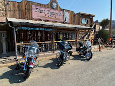
Seligman, AZ My 3rd day started with a run through Seligman, AZ before getting on the bike. There are a few famous locations here and I wanted to get a look around. The main reason for the visit is supposed to be Delgadillo’s Snow Cap – I didn’t learn until later that most of the vehicles were behind the building. Luck for me there were many other attractions in town. A few pictures from the morning Seligman
half-buried, 14-foot-tall pseudo-tiki sculpted of metal, wood, chicken wire, Styrofoam and cement, created in 2004 is worth a quick stop. During my trip it had been painted Pink (vs usual Green) for breast cancer awareness. Pictures of Giganticus.
The last major town in AZ before getting into CA – Kingman, AZ. A stop at the railroad museum (nope closed), a walk around town, enjoying warmth that would soon turn to heat as I headed further west. Welcome to KingmanPictures.
AZ. The ride up into the hills was amazing. Oatman is a village in the Black Mountains of Mohave County, Arizona. It began as a small mining camp when two prospectors struck a $10 million gold find in 1915. Oatman was fortunate it was located on busy U.S. Route 66 and was able to cater to travelers driving between Kingman, Arizona, and Needles, California. Yet even that advantage was short-lived, because the town was completely bypassed in 1953 when a new route was built between Kingman and Needles. Pictures of Oatmanand area.
Top Rock, AZ In searching for Old Trails Bridge I managed to first end up at the Top Rock Marina – alternative access to Lake Havasu. A quiet time around the lake, but still feels plenty warm. A great place for lunch overlooking the water. Old Trails Bridge and Top Rock Pictures.
Needles, CA I wasn’t sure how far into California I would go, but given the length of my days and the access to the Mohave Desert – I decided Needles would be about it. Needles was a major stop on the historic U.S. Route 66 highway from the 1920s through the 1960s. During the Dust Bowl in the 1930s, it was the first town that marked arrival in California. The city is lined with motels and other shops from that era. It was very quiet on a Wednesday, but a nice visit. Pictures around Needles, CA.
Mohave Desert, CA After Needles it was time for a drive into the desert. Some very quiet, long straight roads. There were call boxes along the highway. I spent some time thinking about what the call boxes are connected to and who might answer. I had plenty of water and it turns out there was construction to the peace and the quiet ended when we all ended up packed together going into Nevada. Mohave Desert Pictures.
Lake Mead, NV The final section of the Nevada drive was along Lake Mead with a stop in Echo Bay and on into Utah. Route 66 is a memory, but the roads in this park are amazing – well maintained and have great views. Pictures from Ride.
Day
3 turned out to be 418 miles – a general route via google maps.


No comments:
Post a Comment